
Project Yard Manager
Digital Transparency for Product Movements on Open Yard
Open yards are a central component of many industrial and logistics processes. At the same time, they pose particular challenges for companies: Unlike traditional warehouses, open yards often lack fixed structures, clearly defined storage locations, and digital systems for fully tracking product movements. Pallets are regularly restacked, temporarily placed, or transported over long distances by forklifts – often without clear documentation or up-to-date inventory information.
Forklift operations on expansive outdoor areas add to the complexity. Product locations are not always easy to track, search times increase, and manual processes often lead to errors in stock and inventory. Changing layouts, temporary storage areas, and weather conditions further increase organizational effort.
Existing solutions for area and movement tracking are often associated with high investment and operating costs. The need for specialized hardware, extensive infrastructure, or complex systems makes many of these approaches economically unviable – especially in dynamic open yards that require flexibility.
Our project addresses these challenges. The goal is to develop a flexible, scalable, and cost-efficient solution for digitally mapping product movements on open yards. Unlike existing approaches, we combine multiple technologies to create a practical alternative with reduced technical and financial effort.
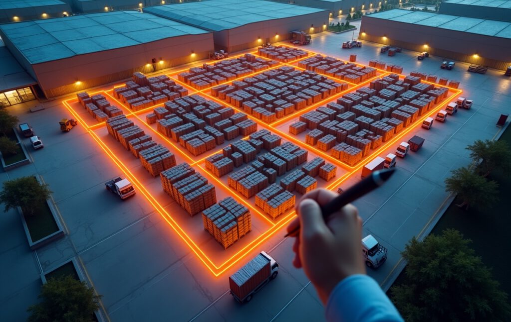
In the current project phase, the focus is on defining and digitally capturing storage areas. Building and site data are integrated via satellite imagery, providing the user with intuitive orientation. Storage areas can be freely defined and structured. Products can then be assigned to the respective areas directly from a central database.
All relevant product data – including pallet sizes and logistical parameters – are automatically retrieved from the database. This enables precise space and capacity calculations. Based on this data, various analyses can be generated, such as total storage area, product-specific capacities, or optimal use of available space.
In the current version, geodata is already collected and stored for each storage area. In the next project phase, this data will be used to visualize information through Augmented Reality directly in the real environment, for example via mobile devices such as smartphones or tablets. Users can access context-sensitive information on site in real time.
In the long term, the system will be expanded with additional functions, including the integration of production and process data, continuous monitoring of material movements, automated inventories, and active control and optimization of operations. This creates a comprehensive solution that provides transparency, simplifies processes, and makes open yards efficiently usable.
A particularly innovative approach for the future is the use of artificial intelligence for chaotic storage management. Instead of storing products in fixed locations, AI dynamically determines the optimal placement of each pallet based on orders, transport paths, and current storage conditions. This intelligent, order-based placement minimizes transport distances, reduces forklift movements, and significantly increases efficiency. At the same time, operating costs are reduced, as storage space is optimally used and unnecessary travel is avoided.
Please note: The demo version of the Yard Manager can currently only be used on desktop devices.
Project-Name
Yard Manager
Project-Status
Development Active, Demo Status (Desktop)
Project-Typ
Hard- und Software
Software-Version
Desktop Yard Manager 1.02.4